Thinking about a waterfront home in Deerfield Beach and planning to keep a boat at your dock? A single fixed bridge between you and the Atlantic can make or break your ocean access. It is common to feel unsure about what those clearance numbers mean or how tides change the picture. In this guide, you will learn how to verify fixed bridge clearance, measure your boat’s height, use local tide data, and ask the right questions before you buy. Let’s dive in.
Why clearance matters in Deerfield Beach
Deerfield Beach sits on the Intracoastal Waterway with canals that feed into it. Your route to the Atlantic often includes fixed bridges that cannot open. If a bridge along your route is too low for your boat, you may be limited to inshore waters or trailering.
Even though local tides are relatively small at about 1-2 feet, that difference can decide whether you clear a bridge on a given day. Clearance affects your boat options, daily routines, marina choices, and future resale appeal to other boaters.
How clearance is measured
Key terms you should know
Vertical clearance is the distance from the water surface to the lowest part of a bridge. Published clearances are tied to a vertical datum, commonly Mean High Water. Always check which datum the source uses.
Operating clearance is the actual clearance at the moment you pass. You calculate it by taking the published bridge clearance and adjusting for the current water level and a safety margin.
The working formula
Actual clearance at time of transit = Published vertical clearance (relative to its datum) − current tide height relative to that datum − your safety margin. Use this to decide if you can safely go under.
Your boat’s air draft
Air draft is the height from your boat’s waterline to its highest fixed point. On sailboats, this is typically the masthead. On powerboats, it might be the radar arch or tower.
Build in a safety margin
Skippers often allow at least 1 foot for small low-profile boats and 2-3 feet for taller vessels or when conditions are uncertain. A margin protects against waves, wakes, and small errors in measurement.
Where to find official numbers
NOAA charts and tides
NOAA nautical charts list published bridge clearances and note the vertical datum. Use nearby NOAA tide stations to see predicted tide heights so you can adjust the published number to the conditions you expect.
U.S. Coast Guard updates
The U.S. Coast Guard Bridge Administration and Local Notices to Mariners provide official information about bridge clearances and any temporary changes, repairs, or restrictions.
FDOT and local public works
Florida Department of Transportation maintains state-road bridges. Broward County and the City of Deerfield Beach maintain certain local bridges. These agencies keep records and announce projects that could affect future clearance.
Local marinas and harbormasters
Local operators and harbormasters share real-time insight on what boats routinely pass, any shoaling or dredging updates, and timing tips for transits.
Step-by-step clearance check
- Measure your boat’s air draft from the waterline to the highest fixed point. Include antennas, radar, and masthead instruments.
- Map your route from the dock to the ocean. List every fixed bridge on that route.
- Get each bridge’s published vertical clearance and confirm the vertical datum used.
- Check predicted tide heights for your planned transit time at the nearest NOAA tide station.
- Subtract the tide height and your safety margin from the published clearance.
- Compare the result to your boat’s air draft. If the number is less than your air draft, do not attempt to pass.
- If needed, plan to transit at a lower tide or adjust your vessel setup if allowed and safe.
Example: If a bridge is published at a certain height relative to Mean High Water, the tide is 0.8 feet above that datum, and you want a 2-foot safety margin, you subtract 2.8 feet from the published number to estimate your safe operating clearance.
Local factors in Broward County
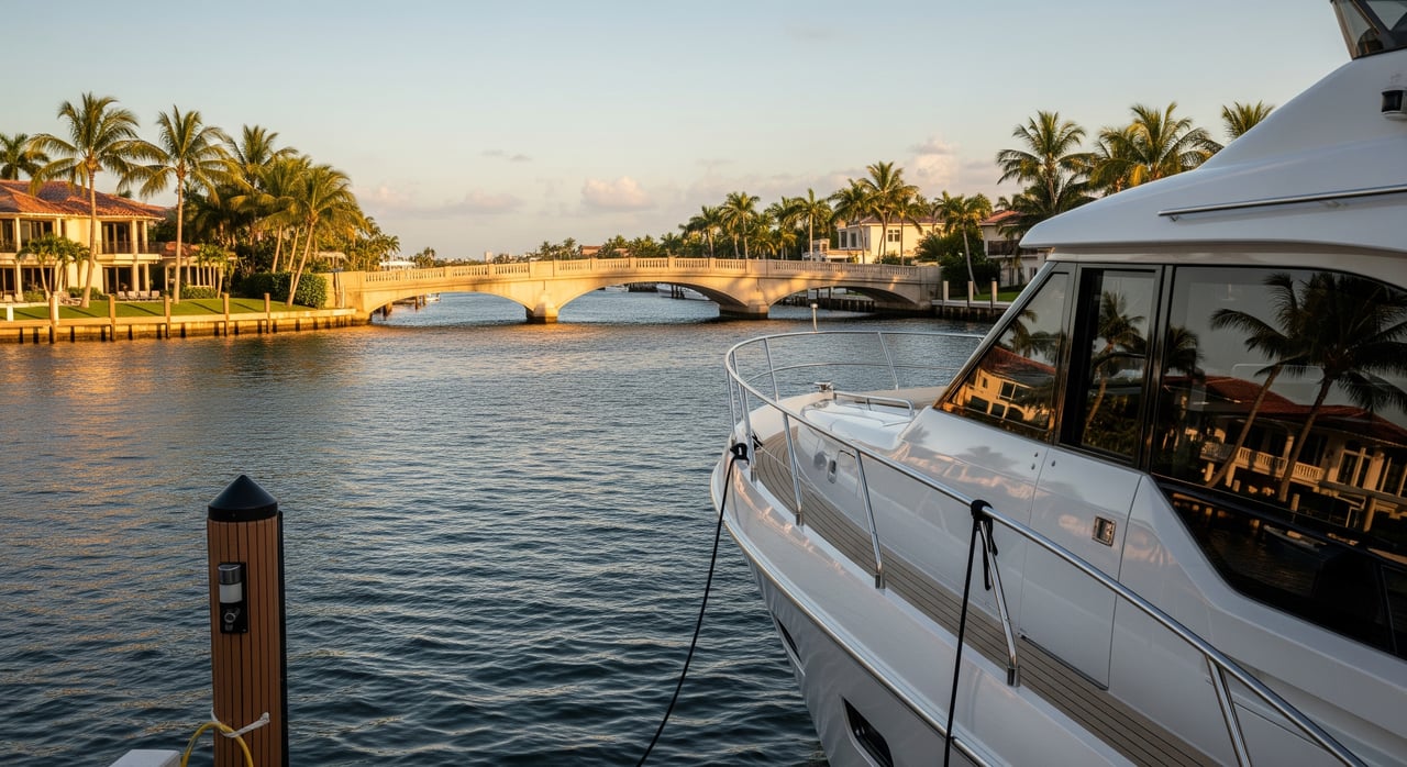
ICW routes and ocean access
Deerfield Beach is part of a connected waterway system. Whether your dock has practical ocean access depends on the sequence of fixed bridges between you and the inlet, plus your vessel height. Some vessels, especially sailboats with tall masts, may be limited to inshore cruising if a low fixed bridge sits on the route.
Canal depths and dredging
Even if you clear a bridge, you also need enough water under the keel. Canal and channel depths change with storms and dredging cycles. Ask about recent dredging and any known shoaling near canal entrances.
Projects and long-term change
Bridge replacement or rehabilitation projects can change clearances over time. Keep an eye on state, county, and city transportation plans. Over decades, sea-level rise can gradually reduce actual clearance and may influence marina operations and insurance.
Storm and hurricane planning
Storm surge temporarily raises water levels, reducing clearance and increasing loads on lines and moorings. Some owners haul out or lower removable structures before storms. Ask about local haul-out capacity and seasonal procedures.
Buyer checklist for showings
- Route and bridges: Ask the listing agent or seller to detail the route to the ocean and list any fixed bridges on the way.
- Documents: Request community or HOA rules about docks, slips, and navigation easements.
- Clearances and datum: Gather the published vertical clearances for your route and confirm the vertical datum for each source.
- Tides: Identify the nearest NOAA tide station you will use for predictions and note the tidal range.
- Depth: Ask the city, county, or harbormaster about canal depth and dredging frequency near the property.
- Operations: Confirm if the dock area is a no-wake zone and check bridge lighting and navigation aids.
- Insurance and marina rules: If using a marina, confirm height, type, and insurance requirements.
- Resale: Keep records of bridge clearances and route details. Documented ocean access can help future marketing.
Typical boat heights
- Small center-console or bay boats: about 6-12 feet.
- Cuddy cabins and small motor yachts: about 10-20 feet depending on structures.
- Trawlers and pilothouse boats: about 14-25 feet, plus any towers.
- Sailboats: about 30-70+ feet. Many sailboats exceed low fixed bridge clearances and require a high-clearance route or alternate access.
Put it all together
Start with your vessel’s air draft, list every fixed bridge, and apply the tide and a safety margin. Confirm canal depths and any local notices before you run the route. If you are early in your search, use these steps to screen properties so you only tour homes that fit your boating plans.
Work with a local expert
You deserve a waterfront plan that matches your boat, your lifestyle, and your budget. With more than two decades helping Broward buyers and sellers, Linda offers a boutique, hands-on approach and knows the details that matter for Deerfield Beach and nearby markets. If you want help mapping routes, coordinating due diligence, or aligning a search with your vessel needs, connect with Linda Hoyt for personalized guidance.
FAQs
How do Deerfield Beach fixed bridges affect ocean access?
- You must fit under every fixed bridge between your dock and the inlet. If your boat’s air draft exceeds the actual clearance at any point, you will be limited to inshore waters or need alternate access.
What does “published vertical clearance” mean on a chart?
- It is the bridge height listed on official sources relative to a vertical datum, often Mean High Water. You still adjust for the current tide and add a safety margin to get actual clearance.
How do Broward County tides change bridge clearance?
- Local tides are typically about 1-2 feet, which is enough to decide pass or no-pass. Subtract the tide height from the published clearance, then subtract your safety margin.
Can a Deerfield Beach fixed bridge be opened for me?
- No. Fixed bridges do not open. Only movable bridges can open on schedule or request, so confirm the bridge type for each crossing on your route.
Who should I contact for official clearance data?
- Use NOAA nautical charts and nearby NOAA tide stations for numbers and context, check U.S. Coast Guard Bridge Administration notices for updates, and consult FDOT or local public works for bridge ownership and projects.
Should I plan for sea-level rise when buying waterfront?
- Yes. Over time, rising water levels can reduce operational clearance and may affect marina rules or insurance. Consider long-term plans if you own taller vessels.